Infrasense Provides Subsurface Utility Engineering (SUE) Mapping Services in Taunton, MA

Infrasense engineers conducted a subsurface utility engineering (SUE) survey to map designated utilities and subsurface obstructions in the vicinity of the Taunton River in Taunton, MA. Electromagnetic induction (EMI) and 3D ground penetrating radar (3DGPR) tools were used as the basis for this survey, and resulting data was analyzed to create final maps of located utilities.
TAUNTON, Mass., Sept. 3, 2025 /PRNewswire/ -- The objective of this subsurface utility engineering (SUE) survey was to map designated utilities and subsurface obstructions along a site in the vicinity of the Taunton River. The prescribed site area surface included mostly asphalt roadways, with some landscaped areas and railroad (RR) right of way.
The electromagnetic induction (EMI) survey was carried out using a Radiodetection 8200 and/or Subsite Electronics 750 R/T tools to locate and trace utilities that were accessible from utility poles, electrical transformers, exposed conduits, and other features. The EMI tools were used in both active and passive mode. Active mode allows for the placement of a signal on a ferrous utility and various frequencies, which are then picked up by a handheld receiver that traces its path. Alternatively, passive mode allows EMI tools to receive 50/60 Hz frequencies associated with active AC power transmitted through a utility, which lets the user trace out buried electrically charged lines. Each utility identified and traced using the EMI method was marked on the ground surface using service specific marking paint colors.
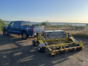
The use of GPR was especially helpful during this survey for detecting the interface between different materials, such as buried utility lines (metal, plastic, etc.) and the surrounding subgrade material. The GPR survey involved the use of an Impulse Radar multichannel array GPR system employing up to 9 GPR antennas with a central frequency of 450-MHz and a typical penetration depth of 10-12 feet (under favorable subsurface conditions). Due to varying site conditions, including mostly grass, the average depth penetration across the site was approximately 8 feet. The GPR system was vehicle-mounted and included an integrated electronic distance measuring instrument (DMI) and a GPS system collecting synchronous data. GPR data was collected in all accessible areas within the project survey limits using overlapping traverses at a rate of 20 scans-per-foot.
Individual GPR data files were then analyzed and assembled into representative 3D models using the synchronous GPS data. Each line of GPR data represents a cross-sectional slice of the subsurface; the contrast at the interface of different materials detected by the GPR provides an identifiable feature which, when it appears in successive adjacent cross sections, is determined to be a utility. The combined 3D model was analyzed and "picked" to extract the position of all known and potential utilities. The targets were then exported with latitude and longitude location data and prepared for final mapping of the individual utilities. These final utility maps, overlaid onto site base-maps, included utilities labeled with their service type on the appropriate quality level, approximate depth information, and service type (where possible).
About Infrasense, Inc.
Since 1987, Infrasense, Inc. has applied advanced technologies to address the most difficult challenges in subsurface scanning. Infrasense's engineers nondestructively extract critical information from a diverse range of structures. In addition to providing ongoing subsurface evaluation services to clients across the country, the firm has also conducted numerous research programs to advance the field of subsurface detection and nondestructive evaluation. To learn more about Infrasense and the services we provide, visit our website: http://www.infrasense.com
SOURCE Infrasense, Inc.


Share this article