SkyFi and ICEYE US Partner to Enable 24/7, All-Weather Earth Observation with ICEYE SAR Satellite Tasking

AUSTIN, Texas, Nov. 12, 2025 /PRNewswire/ -- SkyFi, the leading Earth Intelligence Platform, today announced the integration of ICEYE US synthetic aperture radar (SAR) data into SkyFi's platform.
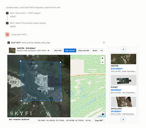
The partnership brings the ICEYE SAR constellation—currently the world's largest commercial radar fleet—directly to SkyFi's growing user base. SkyFi users can now task ICEYE satellites on demand and access archived imagery directly through SkyFi's web platform and mobile app.
With this integration, ICEYE US SAR data is accessible to SkyFi users through the same streamlined process they use for other satellite data: drawing an area of interest, choosing a sensor and imaging mode. Whether tracking port activity, assessing infrastructure, or monitoring a coastline, radar-based imaging from ICEYE US powers solutions to critical GEOINT challenges, providing guaranteed, high-resolution imagery of any location on Earth, regardless of weather conditions or time of day.
"Partnering with ICEYE US brings all-weather, world-class SAR capabilities to the SkyFi platform paving the way for future initiatives that fundamentally change how the public and private sectors access and utilize earth observation," said Luke Fischer, CEO SkyFi.
"Whether our customers are monitoring illegal fishing at night, assessing flood damage through storm clouds, or continuously tracking the movement of military hardware, they now have a fast, reliable tool to get the insights they need, when they need them most. This is a game-changer for industries from disaster response to supply chain management to national security," added Fischer.
Enabling Critical Geospatial Use Cases
The addition of ICEYE US advanced SAR capabilities overcomes a critical limitation of traditional optical satellite imagery, which is often hindered by cloud cover and darkness. By utilizing radar pulses to create images, SAR satellites can effectively "see" through clouds, smoke, and the dark, ensuring reliable data collection and persistent monitoring for time-sensitive and critical missions.
ICEYE satellites utilize a unique advanced phased-array radar system that enables responsive tasking and supports flexible collection modes, from 50cm - 15m resolution spotlight to over 10,000 square kilometer large area scan imaging.
The ICEYE US-SkyFi partnership delivers these capabilities to decision-makers across national security, infrastructure, emergency response, and commercial sectors through a secure, simplified interface. Enterprise customers are able to task satellites through the platform's APIs. Applications span maritime monitoring, border surveillance, infrastructure tracking, and disaster response.
"This partnership with SkyFi fundamentally changes how organizations access and utilize SAR data, removing traditional barriers while maintaining the quality and reliability our customers expect," said Eric Jensen, CEO of ICEYE US.
"SkyFi's intuitive platform makes it simple for anyone to task our satellites. By offering ICEYE US data through their marketplace, SkyFi is putting real-time SAR intelligence at the fingertips of businesses and organizations, enabling them to solve the world's toughest challenges with persistent geospatial intelligence", said Jensen.
Growing SkyFi's Value for Customers
SkyFi's mission to reduce barriers to Earth observation data aligns closely with the ICEYE US commitment to providing SAR data as a global source of truth. The SkyFi platform currently offers optical, SAR, and aerial imagery from multiple providers, supporting customers across energy, defense, infrastructure, insurance, and environmental monitoring sectors.
"ICEYE data is a world-class resource that has a particular impact in maritime applications of synthetic aperture radar due to its combination of resolution and swath. Combined with SkyFi's ease of ordering and powerful overpass appreciation tooling, I am looking forward to making more use of this excellent data source," said Dr. Thomas Dowling, Lecturer in Remote Sensing & Geospatial Science at the University of Auckland | Seascape.
ICEYE US satellite tasking is now available to all SkyFi customers through the SkyFi web platform and mobile app.
About SkyFi
SkyFi is a self-service Earth Intelligence Platform that allows users to run built-in geospatial analytics, task satellites, and access archived imagery. The dual-use platform supports both civilian and defense use cases, with flexible ordering options, transparent pricing, and API access for large-scale workflows.
Customers can use SkyFi's web platform, mobile app, or developer APIs to manage Earth observation projects without needing contracts or in-house GIS teams.
Learn more at www.skyfi.com
About ICEYE US
At ICEYE US, we equip U.S. government agencies, defense contractors, and commercial enterprises with access to timely, reliable, and actionable persistent monitoring. Leveraging the world's largest constellation of advanced synthetic aperture radar (SAR) satellites, we deliver critical insights—anywhere on Earth, regardless of weather or light conditions.
Driven by innovation and a commitment to national security, ICEYE US is a trusted partner in addressing complex challenges, from disaster response and defense operations to environmental change and scientific discovery. Our state-of-the-art solutions enable decision-makers to act with confidence in safeguarding lives, infrastructure, and assets.
Based in the heart of Southern California's defense-tech innovation hub, we are a mission-focused, technology-driven organization, pushing the boundaries of what's possible in Earth observation.
Learn more at www.iceye.us
SOURCE SkyFi


Share this article